Muskogee, Oklahoma Memorial Park Cemetery Indexes 1929-1993

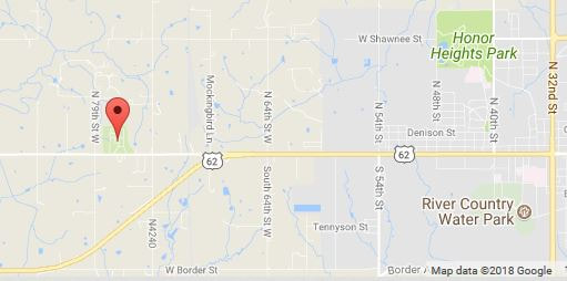
From Muskogee: From intersection of HW 62 & HW 69 drive west to the "Y" of HW 62 and Old Taft Road. Go right at the Y and continue west on Old Taft Road. Cemetery is on the north side of the road.
7600 Old Taft Rd
Muskogee, OK 74401
(918) 682-1311
These indexes were extracted from Microfilm Rolls #OKM 32 and #OKM 33 which are available in the Muskogee Public Library's Local History and Genealogy Department.
You will need Adobe Acrobat Reader DC (free) (or other .pdf viewer) to view some these.
Transcription errors are easy to make so unfortunately, we can't guarantee that all information is accurate. As with all information found on the internet, use what you find here as clues to further research.
You will need Adobe Acrobat Reader DC (free) (or other .pdf viewer) to view some these.
Transcription errors are easy to make so unfortunately, we can't guarantee that all information is accurate. As with all information found on the internet, use what you find here as clues to further research.
Explanation of Columns:
- Inter# = Interment Number as shown on the ledgers.
- Last Name = surname of deceased.
- First Name = given name and/or initials of deceased.
- POB = Place of Birth, abbreviated state initials or name of country.
- Age = Age at death, where information is included.
- Year = Year of interment.
- Page = Ledger Page Numbers, located in the upper left corner.
- OKM# = Microfilm roll number.
Many thanks to Nancy Lasater for this index. She spent countless hours abstracting these records from microfilm, creating the surname indexes, and preparing the .pdf documents used to create this flipbook.